2023 Edition is available now! This edition includes forty new pages and a complete update of all other pages, with attention paid to the current Frisian-language names for the waterways, matching current ANWB and Waterkaarten charts usage. Water depth and bridge height (clearance) have been updated for most waterways.
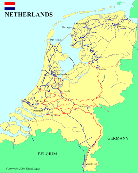
This planning guide includes an overall map of the country showing the network of 161 waterways and the portals connecting into Germany and Belgium, as well as:
To download this eGuide now, click on the Buy Now button below.You will be taken to the online payment processor PayPal. You can pay with a credit card or your PayPal account. You do not need to sign up for a PayPal account; just click on "Pay with a debit or credit card", then select your home country.
IMPORTANT: After completing the payment, please WAIT (up to 60 seconds) to be automatically redirected to the "Download" page for your selected eGuide. DO NOT use your Back button. For downloading instructions and answers to questions go to FAQ-Downloading Guides.
EuroCanals Guide: Waterways of the Netherlands 50.2 Mb, 228 pages US$28.50
Please Note: You are buying the Download (digital PDF) version; also available as a Printed Book
Please Note: the EuroCanals Guides are cruising guides, not navigational charts. They are intended to be used for planning a cruise: they show where you can go and why you might want to go there, with data tables of distances and restrictive dimensions along each waterway. The guides can be used to calculate daily travel estimates. Sources for printed and digital waterway navigation charts are included in the guides.